
Land use in Amazonia (1940-1995) - Leite, C. C., (2008)
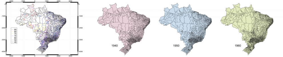
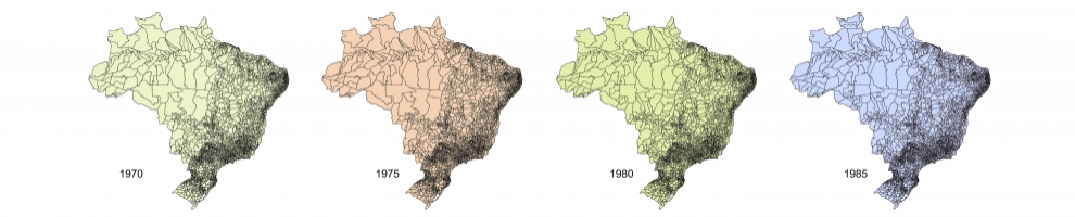
These databases provide spatial patterns of land use in the Amazon each year for the period of 1940 to 1995. Two series of historical maps were generated from two products of the classification of land use for 1995. The first, AMZ-C, contains only a portion of the basins of
the Brazilian Amazon and Tocantins Rivers, and is based on the classification of land use of Cardille et al. (2002), based on data fusion of remote sensing (AVHRR) and agricultural census data. The second, AMZ-R, contains all the legal Amazon and associated regions,
and is based on the land use classification of Ramankutty et al. (2008), generated through the merger of satellite imagery (MODIS and SPOT-VEGETATION) and agricultural census data. To generate the historical database an interpolation algorithm was used. Figures are provided on the fraction of land occupied by crops, natural pastures and planted pastures in NetCDF format (.nc )", with a resolution of 5 'of arc (~ 9 km).